MapPenguinFor municipalities, commercial facilities, and event organizers
MapPenguin ProMarketing, logistics, facilities management, etc.
The new standard in map solutions
Designed to attract and engage.
Designed to attract
and engage.
 No-Code Digital and Indoor Mapping Platform
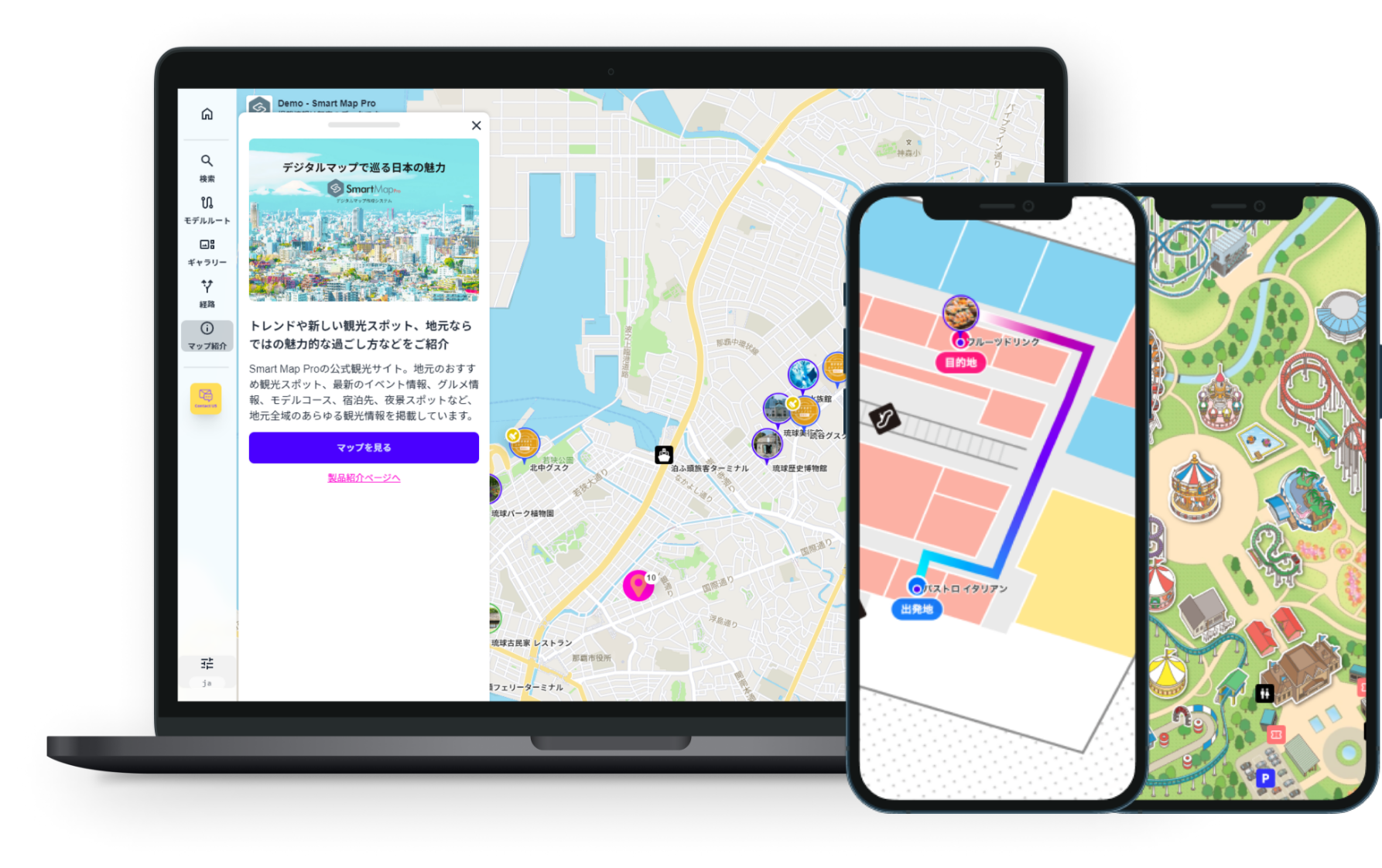

MapPenguin is an advanced system designed to create digital maps for any environment, whether outdoor or indoor.
It is highly versatile, catering to a wide range of applications such as tourist attractions, parks,
commercial facilities, and indoor factory layouts.
By integrating data from sources like the Digital Agency’s open data (GTFS),
the Google Maps Platform, and other external systems,
SmartMap Pro enables you to develop custom maps tailored to your organization’s specific needs.
Map Penguin use cases
- Use Cases
- Hotel Floor Guide
- Park
- Sightseeing spot
- Events
From Paper Maps to Digital Maps
No more printing paper maps or creating PDFs.
 Information can be updated at any time
- With support for 11 languages, the system offers multilingual capabilities, route searches, spot searches, category searches, navigation guidance, voice guidance, congestion updates, and model course recommendations.
Administrators can be granted update permissions to manage and modify information. Bulk import and API integration are also available.

Reduce inquiries within the hotel and alleviate staff workload.
No more need to draw arrows on paper maps to explain directions.
- Provide a comfortable and highly satisfying stay for your guests
- Offer comprehensive guides, including facility and floor maps, spot searches within the hotel, indoor navigation, evacuation routes, and detailed information on amenities such as restaurants, baths, restrooms, and lockers. You can also introduce model courses to local tourist attractions, making it an excellent tool as a sightseeing map for the surrounding area. Supports 11 languages to accommodate international guests.
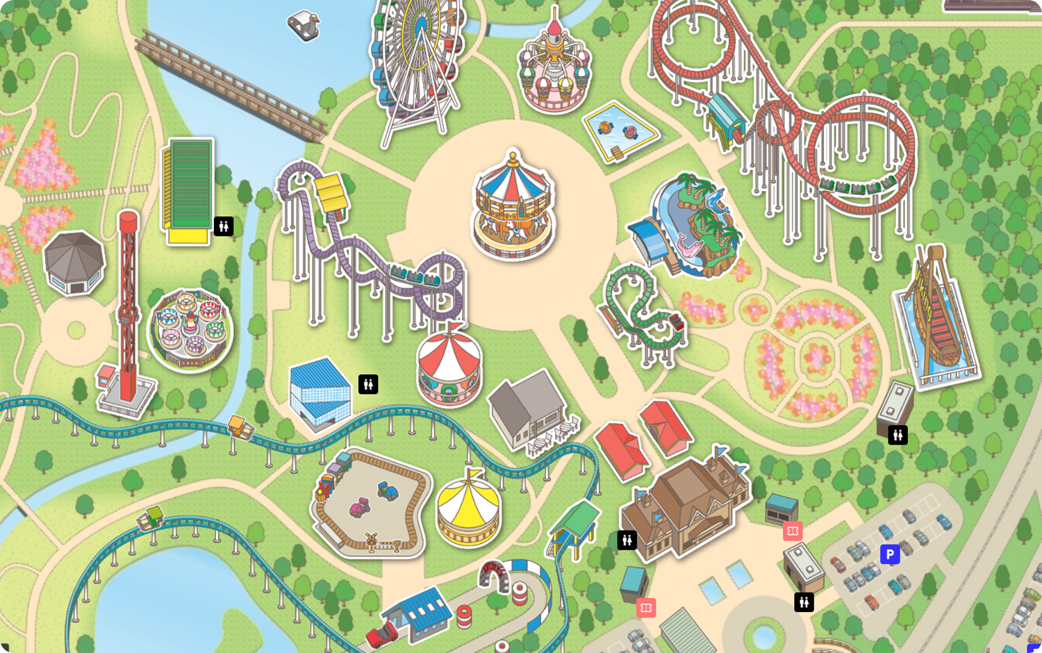
Seamlessly guide visitors to their destinations within the park.
Provide route navigation, category searches, restroom searches, and display congestion information.
- Enhance visitor satisfaction and improve operational efficiency
- Enable searches for rides suitable for children under 120 cm, introduce family-friendly model courses, display congestion updates, and provide detailed spot information. Offer route navigation to restrooms, rides, and restaurants that accept coupons, delivering all the essential information your visitors need for a convenient and enjoyable experience.
Promotions Linked to Tourist Maps
Stamp rallies and digital coupon campaigns are also available.
- More than just a map, a powerful promotional tool
- The map can be integrated with promotional activities such as stamp rallies, digital coupons, and photo contests. Users can also search for spots by clicking photos in a photo gallery. Additionally, videos and audio guides can be incorporated for an enhanced experience.
Scalable for high traffic
Even if access exceeds the limit, the waiting room feature helps reduce congestion.
- Generate personalized
codes for each user’s digital map
-
Supports spot information and route guidance from the venue entrance to recommended booths.
Can also provide navigation across multiple facilities.
Can be linked with booth information from the official website.

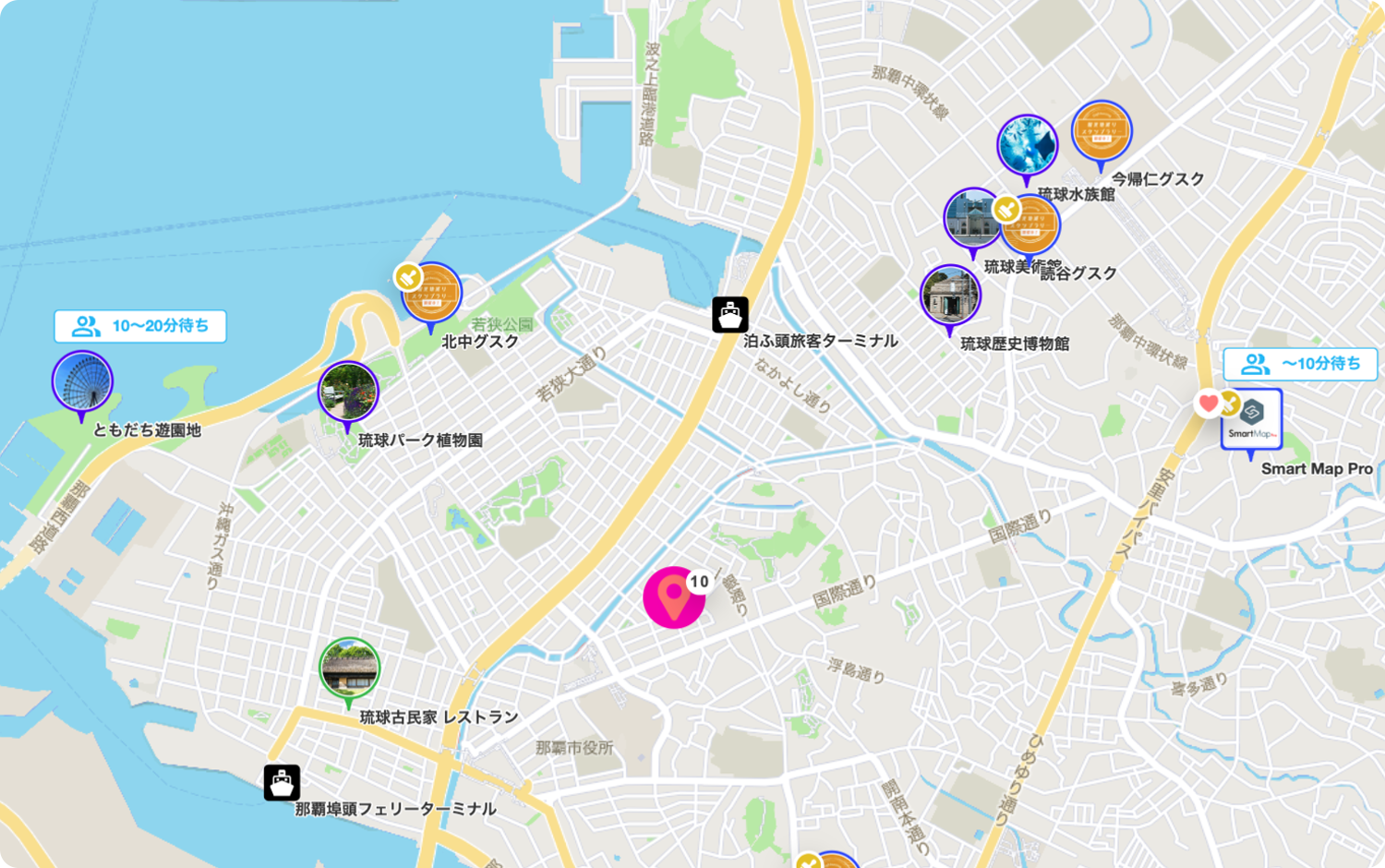
1DX Tourist Guide Map
This platform serves as a comprehensive tourist guide map, allowing you to easily set and publish information about tourist spots, restaurants, and accommodations. Users can navigate smoothly while checking their current location and destination on the map. With support for 11 additional languages, it is ideal for inbound tourism.
The app also features recommended route suggestions, providing users with the best sightseeing itineraries. By enabling efficient visits to tourist attractions, dining spots, and accommodations, it enhances the overall travel experience for users.
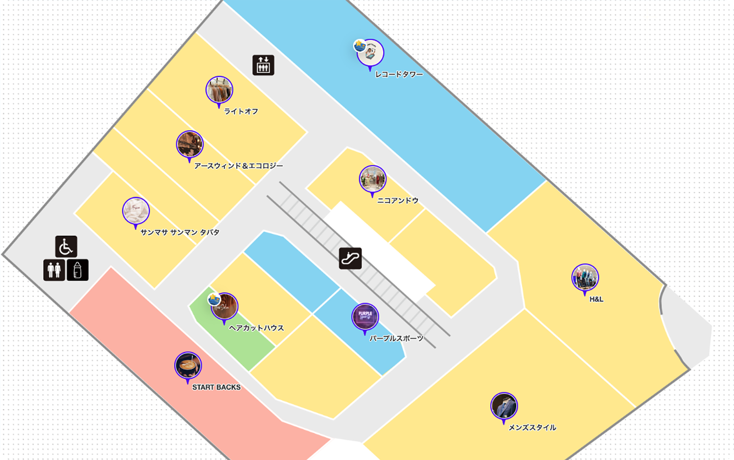
2Facility Indoor Map
Our indoor facility map provides a comprehensive guide for managing routes, tenant information, and amenities within large complexes like shopping malls. This versatile solution is suitable for resort hotel, mixed-use developments, event venues, university campuses, hospitals, showrooms, and large factories.
With an intuitive management interface, you can easily update tenant information and facility details in real-time, saving both time and maintenance costs. This digital solution also reduces the need for printed guides, making operations more efficient and eco-friendly.
- ・We offer a solution that eliminates pay-per-use fees.
- ・Our services support a wide range of map types, including 3D visualizations, 2D floor plans, and custom illustrations.
- ・We enable seamless navigation across multiple facilities within your network.
- ・Our team can also create custom indoor maps tailored to your specific requirements.
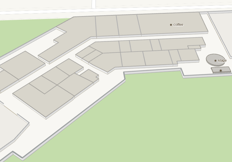
3Park Map
The Park Map is ideal for managing attractions and facilities within large parks and leisure areas.
It can be used in a wide range of settings, including entertainment venues, amusement parks, hotels, and resort areas.
You can use the design customization feature to add illustrations and animations to spots, creating an engaging and visually appealing park map. It also allows you to display real-time crowd information, providing users with the latest updates.
4Disaster Information
(Hazard Map)
In case of a natural disaster, switch the map to display damage areas and evacuation shelter locations, providing essential support for emergency response. You can also integrate open data from the Ministry of Land, Infrastructure, Transport, and Tourism, including flood, earthquake, tsunami, and landslide information, as well as shelter details, for more accurate and comprehensive updates.
5Location-Based Promotion
By leveraging location services, you can launch targeted campaigns based on your customers' locations. When integrated with our campaign tools, these promotions become even more effective, allowing for flexible and personalized offers that cater to your customers' specific needs.
- Stamp Rally

- Encourage user participation by hosting a stamp rally where users collect stamps by visiting designated locations to earn rewards. For more information about the Smart Stamp Rally, click here.
- Coupons and Discounts
- Drive in-store visits by offering digital coupons to customers based on their location, redeemable at nearby stores. Learn more about Smart E-Coupons.
- Contest
- Boost user engagement by hosting contests and promotions that users can enter by checking in at specific locations. Learn more about Smart Contest.
Main Functions
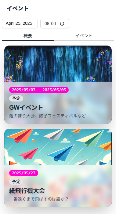
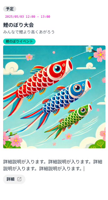
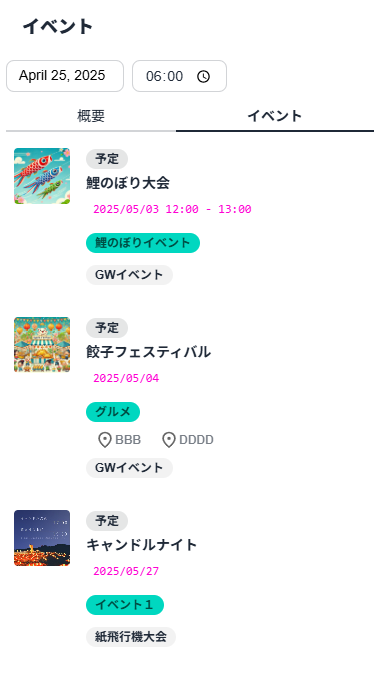
Comes with built-in event hosting capabilities
You can easily display various event information—such as local festivals, campaigns, and workshops—on the map. Registering event dates, locations, and details is smooth, making it a handy tool to encourage participation. Even when multiple events take place simultaneously, they are visually organized on the map for easy understanding of the situation. Additionally, for weather-sensitive events, cancellations or changes can be updated in real-time on the map, providing peace of mind.
- Main Features
-
- ・Only events occurring after the specified date and time are displayed.
- ・Users can directly access event information via QR codes.
- ・It’s also possible to search venues from the event list.
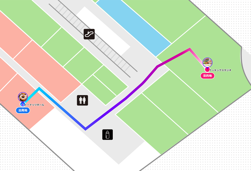
Route Guidance Within the Facility
This is a route guidance feature that supports smooth movement within facilities. By clearly displaying spots and routes on the map, users can intuitively understand their current location and destination, and find the optimal path. It also supports barrier-free routes and multi-floor navigation, making it easy to use for all users.
- Main Features
-
- ・Easily visualize key locations and pathways within your facility
- ・Helps users easily visualize the route from their current location to their destination
- ・Provides barrier-free paths and seamless floor-to-floor navigation
Open Data GTFS Support
A feature that integrates public transportation data—including buses, trains, and ferries—using the GTFS format.
View real-time timetables and connection information on the map to streamline travel planning.
Also functions as a smart mobility platform, offering a more comfortable and efficient transportation experience.
- Main Features
-
- ・Compatible with GTFS (General Transit Feed Specification)
- ・Real-time access to service status, timetables, and connection information
- ・Optimized mobility through seamless integration with transit systems
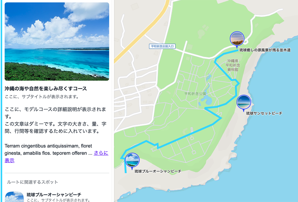
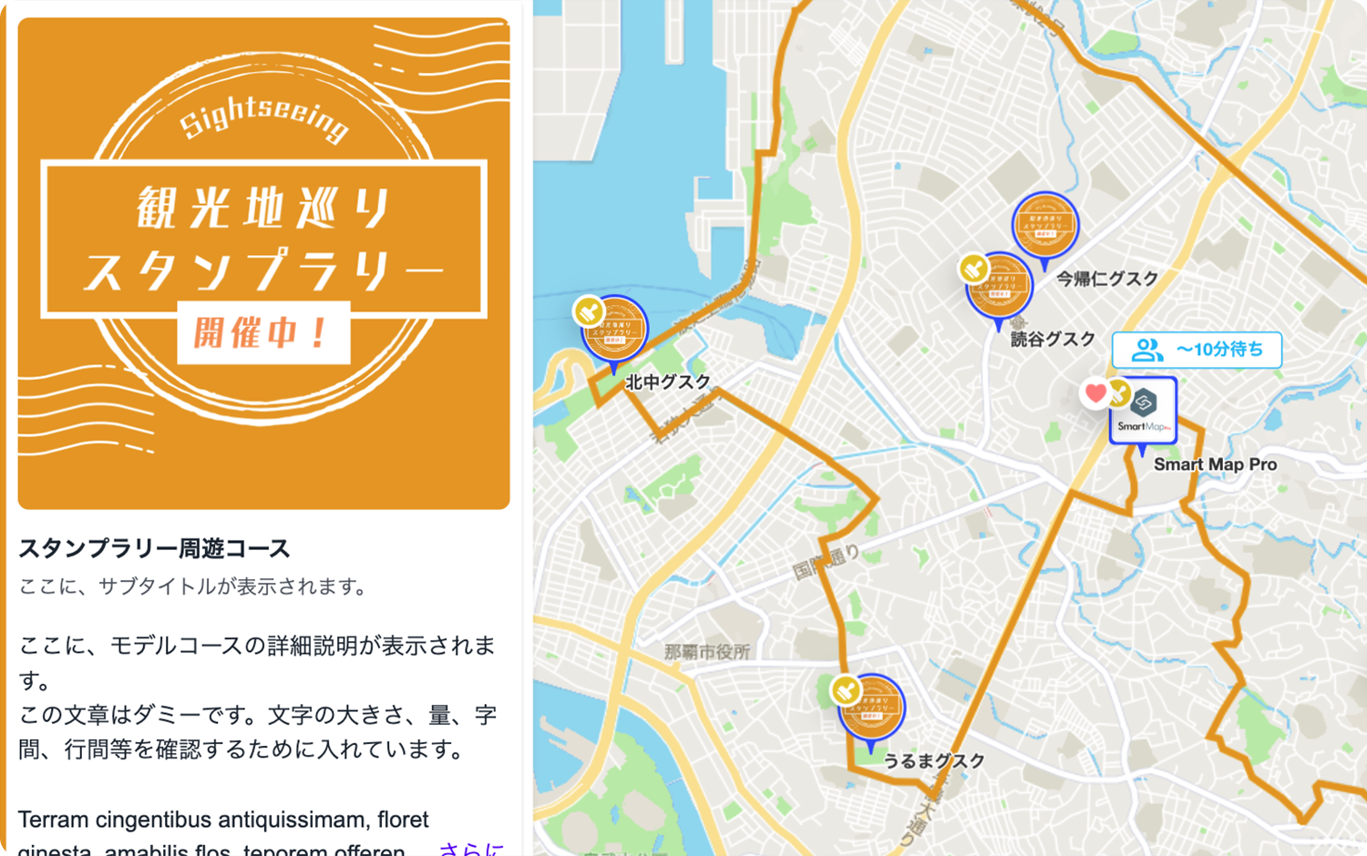
Model (Recommended) Course
A feature that allows you to predefine and provide recommended routes as model courses for sightseeing or facility use.
Users can easily select and follow routes based on their interests or needs, enabling smoother navigation and better on-site experiences.
Ideal for tourist guides, facility navigation, event circulation, and more.
- Main Features
-
- ・Display pre-defined sightseeing and transit routes
- ・Users can simply select and follow a route for smooth navigation
- ・Create themed or purpose-specific route plans with ease
-
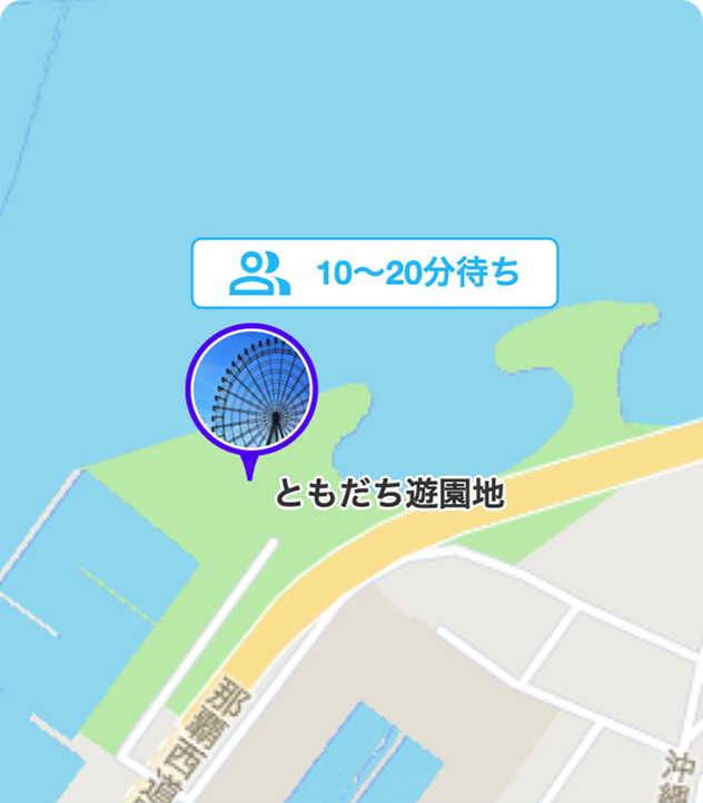
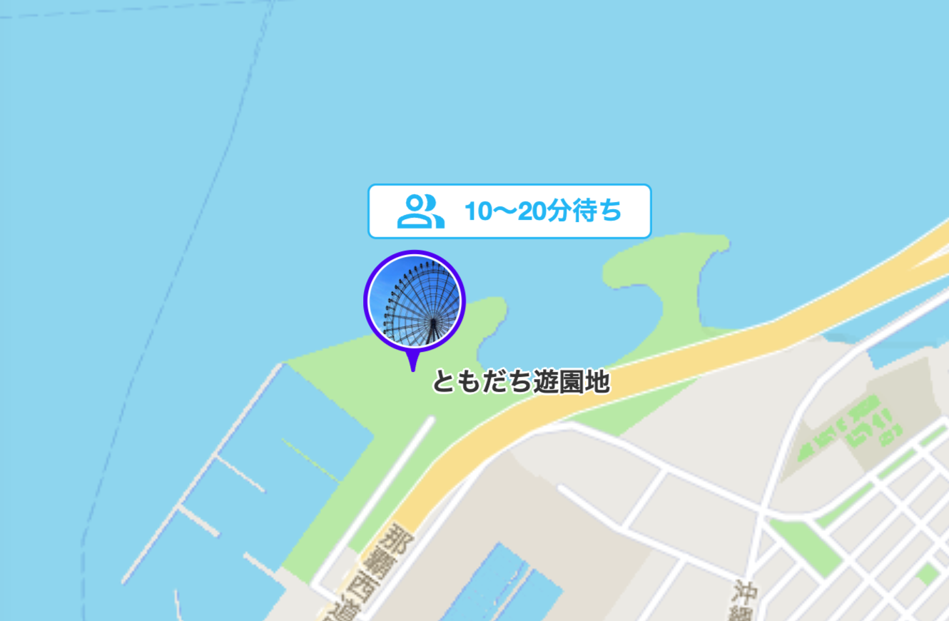
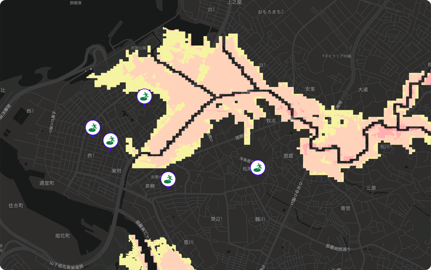
Crowd Information
The crowd information feature monitors real-time crowd levels at facilities and areas,providing users with up-to-date information. Using past data, it also offers crowd trends based on specific times and days of the week, helping users plan their visits more effectively to avoid crowded areas.
-
Layering Illustrations
When you enable the evacuation route overlay in the upper right corner, the evacuation routes will be displayed. You can also use this feature to display detour routes, depending on your needs. The original illustration remains unchanged, allowing for flexible customization.
-
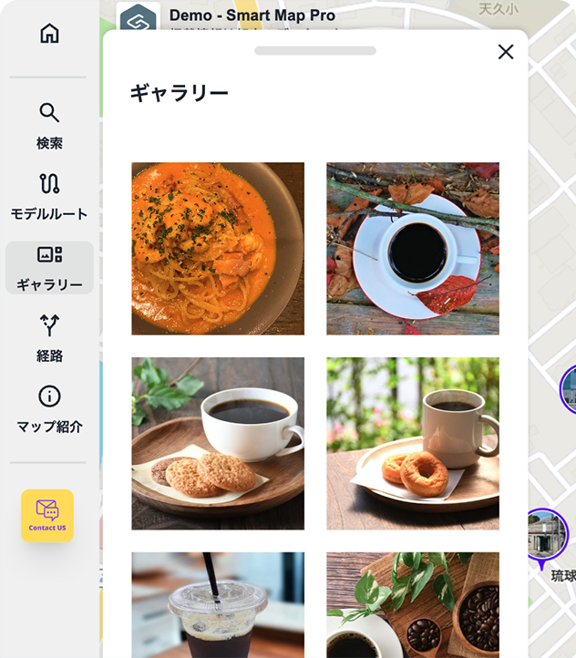
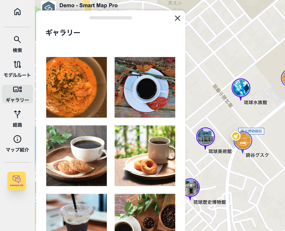
Photo Gallery
The photo gallery randomly displays images of various locations, allowing users to visually explore and discover points of interest. This intuitive feature makes it easier to identify and find destinations.
Includes a variety of additional features
-

The first view displays your service logo
Your service logo is shown when the map loads, making it a powerful tool for branding.
-

Suggest Feature
As users begin typing in the search bar, real-time suggestions based on their input are displayed.
-

IMDF Compatible
The floor map format for facilities supports IMDF (Indoor Mapping Data Format). We also offer assistance in creating IMDF maps.
-

Private Maps
Login FunctionalityIncludes a standard login feature, ideal for restricting access to company personnel or authorized individuals only.
-

Supports 30,000 spot registrations
Efficiently manage detailed information across large areas while smoothly displaying extensive datasets.
-

Mobile and signage compatible
The platform features a responsive design, ensuring a comfortable user experience on smartphones and tablets. It also supports digital signage displays.
-

Supports 11 Languages with Multilingual Automatic Translation
The system supports 11 languages and includes an automatic translation feature, allowing spot information to be translated into multiple languages seamlessly.
-

Filtering by category
Easily filter places by category to view specific information.
-

Highly Customizable
Spot MarkersThe standard feature allows you to freely customize markers with original graphics or animated illustrations using CSS.
-

Map Access Restrictions and SSO Integration
To keep your maps private, you can implement SSO (Single Sign-On) to restrict access exclusively to authorized users.
-

Data Integration
Import data from the Google Maps Platform and seamlessly integrate it with existing databases or CMS via API. This allows you to combine and utilize your own custom data effectively.
-

Audio Guid
This service provides audio information for each location.
The audio guide offers detailed explanations of historical backgrounds, art interpretations, and cultural insights, enhancing your experience at tourist attractions and museums.
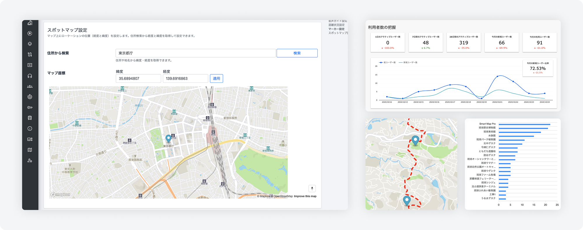
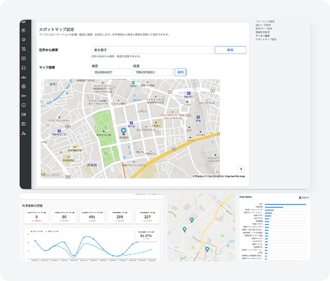
Simple dashboard
-
 Dashboard
With an intuitive interface, you can easily add, edit, and update information about locations, routes, and floors within the facility. The dashboard provides a clear overview of the entire system at a glance.
-
Insights (Data Analysis)
Visualize usage and user trends. Analyze user numbers, attributes, visit frequency, and behavior using heat maps.
-
Access Control and Permission Management
For multiple users accessing the admin screen, editing and viewing rights can be restricted based on their roles.
-
Import/Export
The import and export functions allow for easy integration of external data and the ability to save or share existing data.
Demo
You can easily display the map by embedding an iframe on your website.
Additionally, you can display the map within your app using a WebView.
- Convention & Exhibition Map
- Digital Map
- Park Map
- Tourist Map
- Indoor Map
- Multilingual Map
- Hazard Map
Our Clients
We offer proven solutions for large facilities and factories, including internal Indoor maps, vacant property searches, and retail store listings. Our team provides tailored development to meet each client's needs, from employee ID integration via SSO (Single Sign-On) to external database connections.
Pricing
Comes Standard with a Wide Range of Features

About the origin of the name
About the origin of the name
"MapPenguin" is a name inspired by the penguin—an animal known for its excellent sense of direction and exploratory nature—combined with the idea of "Mapping in," meaning to map or organize information.
The concept behind the name is to visualize complex information as a digital map, as if journeying through a sea of information alongside a curious penguin, guided by inspiration and ideas.
A digital map of knowledge—guided by the Adélie penguin
In the harsh, icy wilderness of Antarctica, the Adélie penguin survives and thrives.
Despite their small bodies, they travel over 5,000 kilometers each year, navigating with precision between breeding grounds and feeding areas.
Swimming through frozen seas, braving fierce winds, and moving in harmony with their colony,
they instinctively know where they are—and where they need to go.
Their journey echoes our own as we navigate the maze of information, seeking clarity and direction.
MapPenguin is a digital mapping tool inspired by the Adélie penguin—an expert navigator in the vast Antarctic wilderness.
It organizes information and visualizes your thinking. From complex data, it uncovers “what is where now” and “how things are connected,”
drawing the relationships of knowledge and ideas as a clear, intuitive map.
This is more than simple mapping—it’s a journey of organizing and structuring fragments of thought and inspiration, transforming them into strategy.
Just as the Adélie penguin traverses icy plains,
MapPenguin serves as your navigator on the adventure of knowledge.