MapPenguin ProMarketing, logistics, facilities management, etc.
Real-time mapping of business system data
Designed to attract and engage.
Designed to attract and engage.
 No-Code Digital and Indoor Mapping Platform
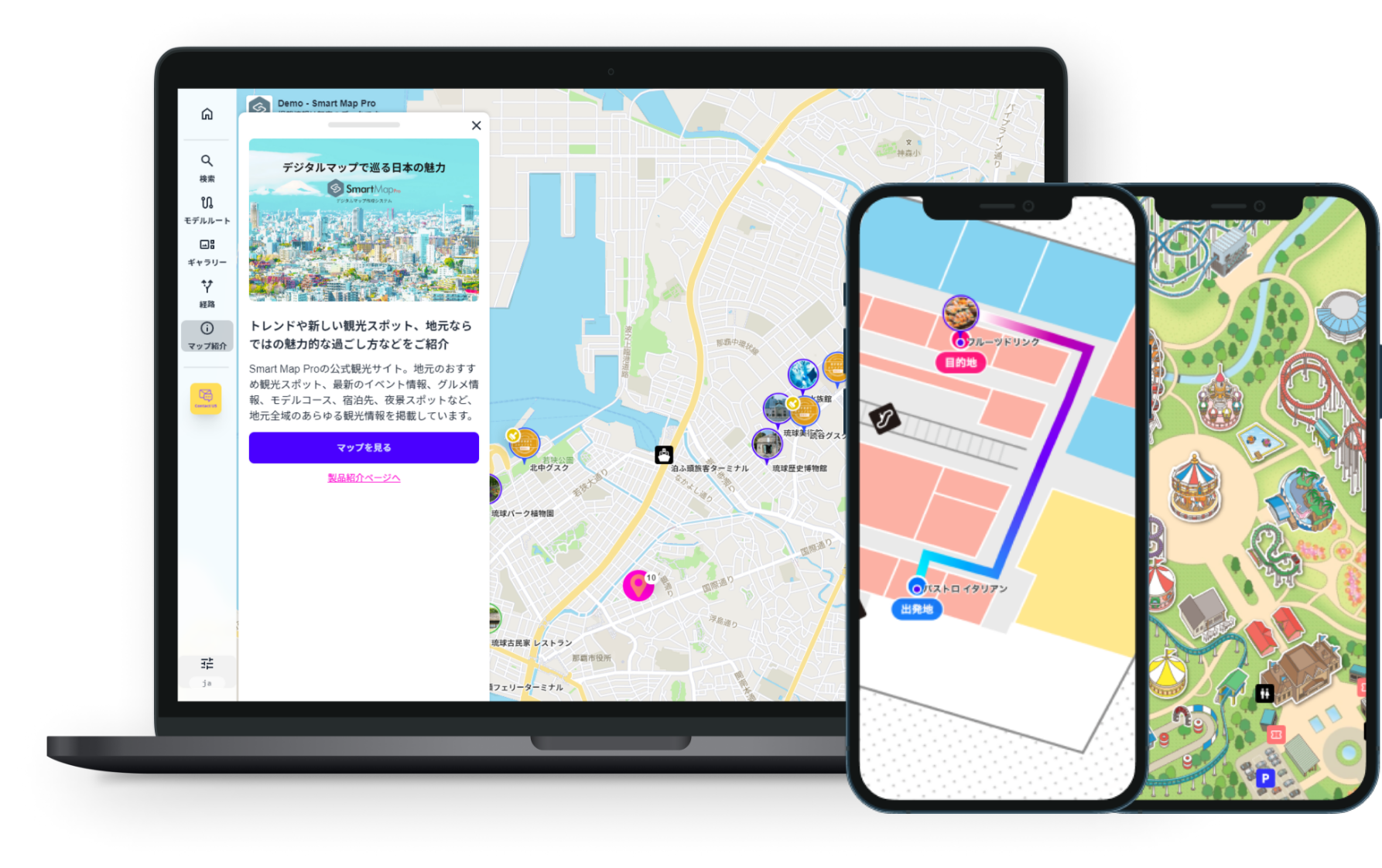

MapPenguin (formerly SmartMapPro) integrates location data with internal business information through API connectivity, helping improve operational efficiency.
Visualize the real-time locations of sites, vehicles, and personnel,
with the ability to analyze movement history and behavioral patterns.
You can also manage essential on-site information on a single map
—such as nearby facilities, disaster alerts, optimal route guidance, and equipment placement.
Use Cases for MapPenguin Pro

Drive digital transformation with interactive maps
No more managing data in Excel or PDF files.
 Powerful support for internal operations
-
From sales and logistics to on-site work and asset management, MapPenguin enables map-based data search and extraction across all business scenes.
It helps streamline operations, enhance decision-making accuracy, and significantly accelerate business with your company and partners.

Analyze location insights
Discover opportunities for operational improvement by understanding stay durations and movement patterns.
- Every movement tells a story
-
By analyzing detailed location data—such as dwell time, movement patterns, and frequency of access—you can uncover actionable trends to enhance operations and services.
Visualizing visitor and employee behavior helps support on-site improvements and smarter decision-making, including congestion prevention, layout optimization, and more effective marketing strategies.

1
Boost your sales power with map-driven insights
Transform your sales approach with digital mapping.
Improve your sales quality and speed through enhanced visibility and optimization.
Plot customer locations and demographic data on the map to instantly visualize the distribution of target segments and competitors.
Utilize color coding and filtering features to quickly and accurately identify potential customers in specific areas and develop effective area marketing strategies.
By integrating with sales support tools, visit histories and customer information are reflected on the map, enabling real-time sharing of each sales representative’s activities.
Optimizing visit routes reduces travel time and maximizes opportunities for face-to-face meetings.
These capabilities strengthen on-site decision-making and responsiveness, directly enhancing the overall sales performance of your team.

2
Map solutions to enhance security operations
Achieving safety and efficiency simultaneously
Patrol, direct, and record—all in one.
Maps that support on-site decision-making.
Our digital map solution specialized for security operations supports efficient patrol management and rapid response by optimizing patrol routes and providing real-time staff location tracking.
GPS-collected locations of sites, facilities, personnel, and vehicles are visualized on the map, offering comprehensive situational awareness.
It is also effective for wide-area coverage and optimal resource allocation.
Each security point can be linked with procedures and contact information, enabling swift and accurate responses during emergencies.
Recording response histories helps prevent recurrence and improves future operations.

3
Asset Management and Maintenance Support
Visualize your assets on the map to achieve efficient management.
Visualize assets on the map—eliminate inefficiencies in management.
By centrally managing dispersed assets such as equipment and real estate on a map, you can intuitively grasp their locations and attributes, enabling more efficient management and enhanced visibility. Linking maintenance histories and inspection schedules to each asset on the map helps prevent oversights and duplicate work, allowing for more planned and organized operations.
In case of abnormalities or malfunctions, the precise location on-site can be quickly identified, enabling swift instructions and response coordination to the most suitable personnel. Moreover, accumulated location and historical data can be leveraged for equipment renewal planning, long-term asset strategy development, and risk management—supporting the sustained preservation and enhancement of asset value.
Our map-based asset management solution achieves both operational efficiency on the ground and strategic asset utilization.

4
Logistics and Delivery Support
Achieve efficient deliveries by considering time, distance, and traffic conditions.
Revolutionize logistics with optimized routing.
Automatically generate optimized delivery routes for multiple destinations, taking into account time, distance, and real-time traffic conditions. This significantly reduces delivery costs and transit times, supporting efficient logistics operations.
With real-time tracking of delivery vehicles, early detection of delays is possible, enabling accurate estimated time of arrival notifications to customers.
Delivery status and travel history are recorded and managed on a map, allowing analysis of driver patterns, workload, and promotion of safe driving, which leads to operational improvements.
Furthermore, leveraging this information helps reduce redeliveries and enhances customer service accuracy. It also contributes to lowering environmental impact, supporting the development of a sustainable logistics system.
Our map-based delivery support tool ensures accurate, efficient deliveries while improving customer satisfaction.
Key Features

Smart user management with SSO
Implementing Single Sign-On (SSO) enables users to access multiple systems with a single authentication, greatly enhancing user convenience.
By reducing the number of times users need to enter IDs and passwords, it prevents work interruptions caused by input errors or forgotten credentials.
Administrators can centrally manage user information, improving security while reducing operational burden.
SSO supports a wide range of environments, from internal systems to cloud services, allowing you to build a secure and efficient authentication framework.

Real-time visualization of map data through API integration with core systems
By leveraging API integration, various data accumulated in core systems—such as customer information, property details, and work performance—can be consolidated and displayed on a map.
This prevents redundant data management and enables real-time visualization of the latest status on the map.
Not only does it improve operational efficiency, but it also facilitates smooth information sharing between field and management teams, supporting faster decision-making.
-
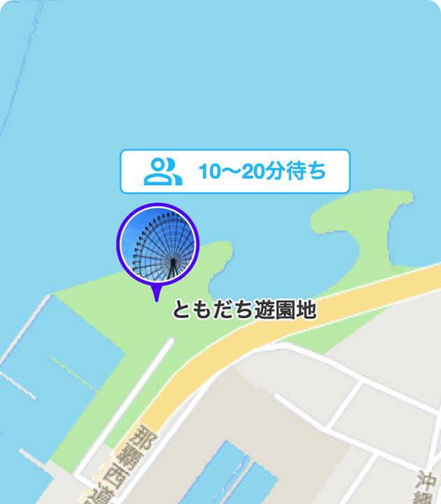
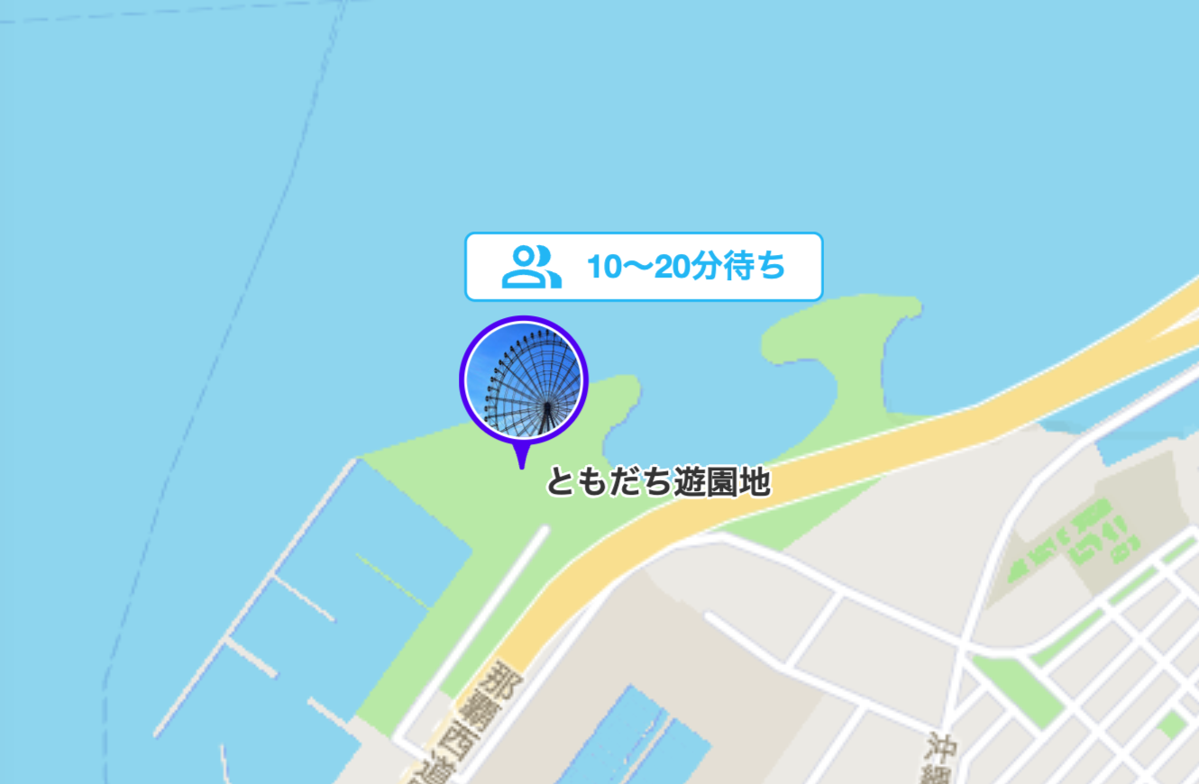
Crowd Information
The crowd information feature monitors real-time crowd levels at facilities and areas,providing users with up-to-date information. Using past data, it also offers crowd trends based on specific times and days of the week, helping users plan their visits more effectively to avoid crowded areas.
-
Layering Illustrations
When you enable the evacuation route overlay in the upper right corner, the evacuation routes will be displayed. You can also use this feature to display detour routes, depending on your needs. The original illustration remains unchanged, allowing for flexible customization.
-
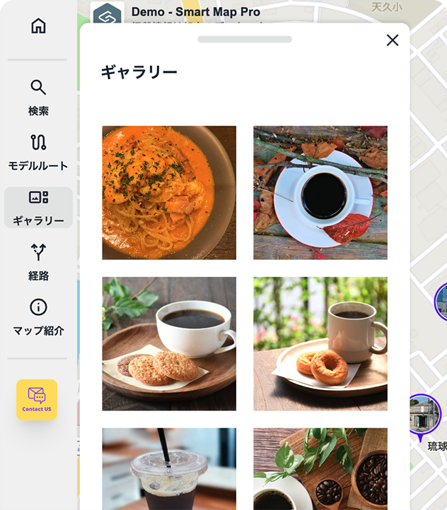
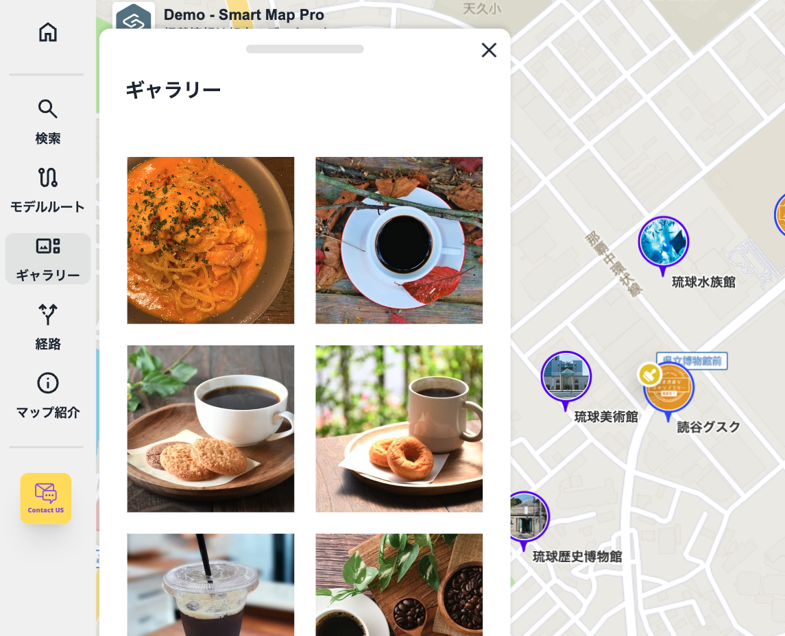
Photo Gallery
The photo gallery randomly displays images of various locations, allowing users to visually explore and discover points of interest. This intuitive feature makes it easier to identify and find destinations.
Includes a variety of additional features
-

The first view displays your service logo
Your service logo is shown when the map loads, making it a powerful tool for branding.
-

Suggest Feature
As users begin typing in the search bar, real-time suggestions based on their input are displayed.
-

IMDF Compatible
The floor map format for facilities supports IMDF (Indoor Mapping Data Format). We also offer assistance in creating IMDF maps.
-

Private Maps
Login FunctionalityIncludes a standard login feature, ideal for restricting access to company personnel or authorized individuals only.
-

Supports 30,000 spot registrations
Efficiently manage detailed information across large areas while smoothly displaying extensive datasets.
-

Mobile and signage compatible
The platform features a responsive design, ensuring a comfortable user experience on smartphones and tablets. It also supports digital signage displays.
-

Supports 11 Languages with Multilingual Automatic Translation
The system supports 11 languages and includes an automatic translation feature, allowing spot information to be translated into multiple languages seamlessly.
-

Filtering by category
Easily filter places by category to view specific information.
-

Highly Customizable
Spot MarkersThe standard feature allows you to freely customize markers with original graphics or animated illustrations using CSS.
-

Map Access Restrictions and SSO Integration
To keep your maps private, you can implement SSO (Single Sign-On) to restrict access exclusively to authorized users.
-

Data Integration
Import data from the Google Maps Platform and seamlessly integrate it with existing databases or CMS via API. This allows you to combine and utilize your own custom data effectively.
-

Audio Guid
This service provides audio information for each location.
The audio guide offers detailed explanations of historical backgrounds, art interpretations, and cultural insights, enhancing your experience at tourist attractions and museums.
Demo
You can easily display the map by embedding an iframe on your website.
Additionally, you can display the map within your app using a WebView.
- Convention & Exhibition Map
- Digital Map
- Indoor Map
Our Clients
We offer proven solutions for large facilities and factories, including internal Indoor maps, vacant property searches, and retail store listings. Our team provides tailored development to meet each client's needs, from employee ID integration via SSO (Single Sign-On) to external database connections.
Pricing
Comes Standard with a Wide Range of Features

About the origin of the name
About the origin of the name
"MapPenguin" is a name inspired by the penguin—an animal known for its excellent sense of direction and exploratory nature—combined with the idea of "Mapping in," meaning to map or organize information.
The concept behind the name is to visualize complex information as a digital map, as if journeying through a sea of information alongside a curious penguin, guided by inspiration and ideas.
A digital map of knowledge—guided by the Adélie penguin
In the harsh, icy wilderness of Antarctica, the Adélie penguin survives and thrives.
Despite their small bodies, they travel over 5,000 kilometers each year, navigating with precision between breeding grounds and feeding areas.
Swimming through frozen seas, braving fierce winds, and moving in harmony with their colony,
they instinctively know where they are—and where they need to go.
Their journey echoes our own as we navigate the maze of information, seeking clarity and direction.
MapPenguin is a digital mapping tool inspired by the Adélie penguin—an expert navigator in the vast Antarctic wilderness.
It organizes information and visualizes your thinking. From complex data, it uncovers “what is where now” and “how things are connected,”
drawing the relationships of knowledge and ideas as a clear, intuitive map.
This is more than simple mapping—it’s a journey of organizing and structuring fragments of thought and inspiration, transforming them into strategy.
Just as the Adélie penguin traverses icy plains,
MapPenguin serves as your navigator on the adventure of knowledge.